Amarnath Cloud Burst : Another Act of Climate Change
Incidences of cloudburst, flash flooding and landslide cannot be ruled out

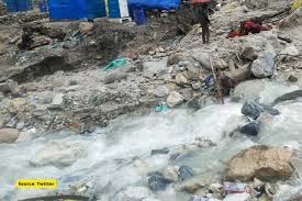
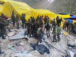
Ever since Monsoon has picked up pace, hilly states of Jammu and Kashmir, Himachal Pradesh and Uttarakhand have been recording incidences of cloudbursts, flash flooding and landslides. The most recent one is the cloudburst near the holy cave shrine of Amarnath, which has left several people dead and missing.
With Monsoon covering the entire country, moisture laden easterly winds have been travelling from lower levels, reaching up to Western Himalayas. These winds have been colliding with the westerly winds flowing across the upper levels. Convergence of the winds flowing from opposite directions led to formation of cumulonimbus clouds over the Kashmir region.
In the hilly region, winds do not tend to travel at a faster pace and sometimes get trapped over a certain area, bringing torrential showers and even a cloud burst. Similar situation was witnessed near Amarnath. Kullu too witnessed a cloud burst last week owing to similar weather conditions. Cloud burst can be defined when a localised area receives very heavy rainfall to the tune of 100mm or more within an hour along with squally winds and lightning. Meanwhile, a rainfall event is defined as mini cloud burst if a certain area records more than 50 mm in two consecutive hours. These occurrences are predominant over the mountainous regions of northern part of India, especially during the Monsoon season.

According to a study, Assessment of climate change over the Indian Region, “Cloudbursts in India occur when monsoon clouds associated with low-pressure area travel northward from the Bay of Bengal across the Ganges Plains onto the Himalayas and ‘burst’ in heavy downpours.”
Forecast Weather conditions remain conducive for Kashmir region to witness some more incessant showers. With the western end of the Monsoon trough now shifting northwards towards the foothills of Himalayas, there are chances of heavy to very heavy rainfall across Uttarakhand. Incidences of cloudburst, flash flooding and landslide cannot be ruled out.
Expect more intense and frequent cloudburst events, courtesy Climate change As per a research, analyses from the observations show a decline in number of thunderstorm days (1981–2010 relative to 1950–1980) by 34% over the Indian region, while there is a rise in short-span high-intensity rain occurrences (short-lived cloudburst and mini-cloudbursts) along the west coast of India (5 per decade) and along the foothills of western Himalayas (1per decade) during the 1969–2015 period (high confidence).
Frequency of cloudburst events in the western Himalayan region has been on the continuous rise due to faster evaporation rates from glacial lakes at high altitudes, as a consequence of global warming.
Besides, with the increasing global temperatures, winds can hold more moisture. Hence, this increased moisture can lead to increased amount of short duration intense rainfall. Scientific evidences have already confirmed that extreme rainfall is going to get intense and frequent. Cloudburst could be more as well as intense due to global warming.
The writer of this article is Dr. Seema Javed, a known Environmentalist, Journalist and Communications Expert


