

Nepal Disaster: Ice-Rock Avalanche Turned Into Flash Flood With Virtually No Warning
Himalayan catastrophe exposes growing threat of sudden, cascading mountain hazards
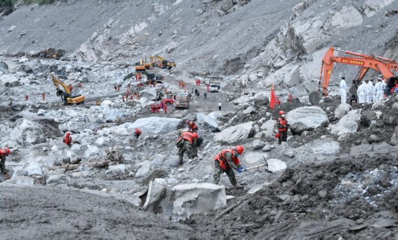
The devastating flash flood that struck Nepal’s Rasuwa district on August 26 was most likely triggered by a massive ice-rock avalanche that plunged from an altitude of around 5,200 metres, scientists have concluded. The event unfolded with virtually no warning, highlighting the growing difficulty of protecting Himalayan communities from sudden and cascading mountain hazards.
According to the International Centre for Integrated Mountain Development (ICIMOD), the collapse occurred at about 8:37 am Nepal Standard Time and generated a magnitude 5.2 seismic signal. Within minutes, the resulting debris flow moved downstream and reached the Bhotekoshi River. Scientists analysing satellite imagery, seismic data, video footage, numerical models and regional climate information believe an ice-rock avalanche, rather than a conventional glacial lake outburst flood (GLOF), was the most likely trigger.
The disaster demonstrates a major weakness in conventional early-warning systems. Unlike rising water levels or known glacial lakes, ice-rock avalanches can originate from unstable slopes, glaciers or areas that are difficult to observe. Predicting exactly where and when such failures will occur remains extremely challenging.
ICIMOD Senior Cryosphere Specialist Dr Farooq Azam said there was no detection and effectively no time to issue a warning because the event was a sudden-onset hazard that conventional systems could not capture.
Experts say the response therefore cannot rely solely on early-warning technology. Stronger land-use planning, resilient infrastructure, community awareness and assessments of how changing environmental conditions could affect infrastructure throughout its lifetime are also urgently needed.
The wider Himalayan risk is being amplified by rapid environmental changes. ICIMOD’s glacier assessments show that Himalayan glaciers have been shrinking rapidly, with mass loss accelerating since 2000. Around 89% of the years covered by 50 years of observations recorded negative glacier mass balance. The region has also experienced significant warming, with reported rates of 0.15°C to 0.60°C per decade during the 21st century.
Researchers also point to declining snow cover, degrading permafrost and rising black-carbon concentrations as important warning signs. Permafrost degradation can increase erosion, landslides and slope instability, posing risks to roads, railways and hydropower infrastructure across the Himalayas.
The Rasuwa disaster has therefore renewed calls for a regional approach to Himalayan risk management, including stronger cross-border monitoring, resilient infrastructure, better land-use planning and greater use of indigenous knowledge in disaster-risk planning.
The central lesson is stark: in a rapidly changing Himalayan environment, some hazards may move faster than warning systems can respond. Preparedness and resilience must therefore begin long before the next mountain collapse.
The writer of this article is Dr. Seema Javed, an environmentalist & a communications professional in the field of climate and energy